
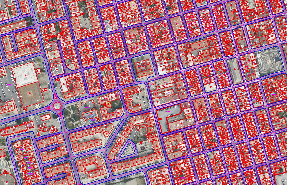
GIS Mapping & Spatial Data Services
High-resolution mapping, geodatabase creation, spatial analytics, and utility mapping.
Aerogeonix is a global engineering and geospatial services partner specializing in high-accuracy GIS Mapping, LiDAR Classification, Photogrammetry, Scan-to-BIM, and Telecom Network Design (FTTH/FTTX). We support enterprises across the US, UK, and Europe with scalable, quality-driven solutions that accelerate project delivery and reduce operational costs.


From telecom operators to engineering firms and GIS agencies, our clients rely on us for unmatched precision, timely delivery, and cost-optimized services.
High-resolution mapping, geodatabase creation, spatial analytics, and utility mapping.
Advanced point-cloud classification, feature extraction, and terrain modelling with industry-leading accuracy.

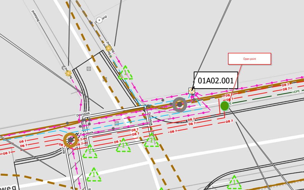
End-to-end telecom engineering—feasibility, route planning, drafting, BOQ, and permit-ready design packages.
Orthomosaic generation, 3D modelling, contour extraction, and aerial image processing.

Converting laser scans into accurate 3D BIM models for architecture, infrastructure, and facility management.

Advanced drone-based outputs and geospatial processing that support planning, analysis, and engineering delivery.
Let’s build the future of geospatial intelligence together.
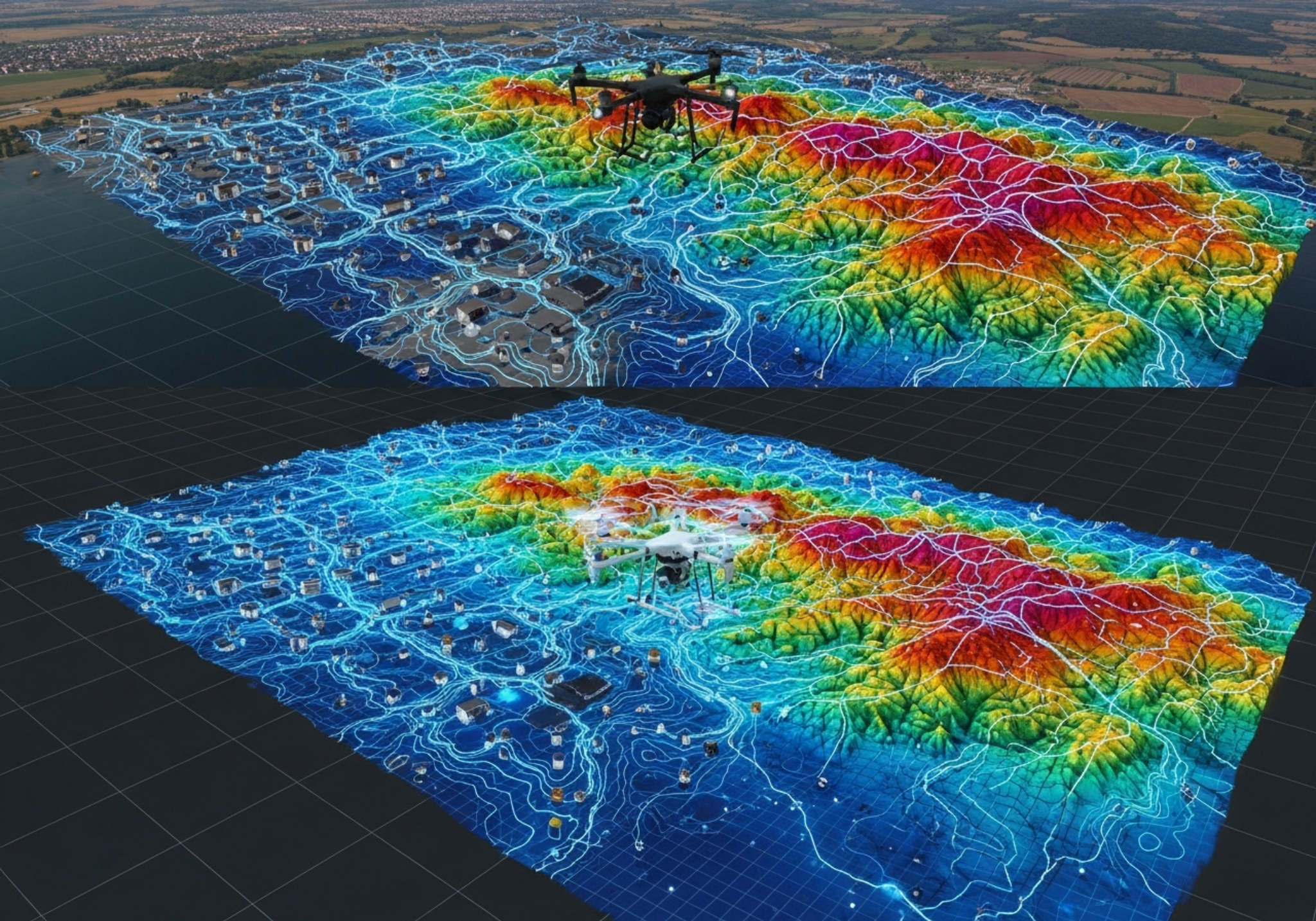
Integrated drone, telecom, and digital city visualization.
Future-ready geospatial city visualization and data layers.
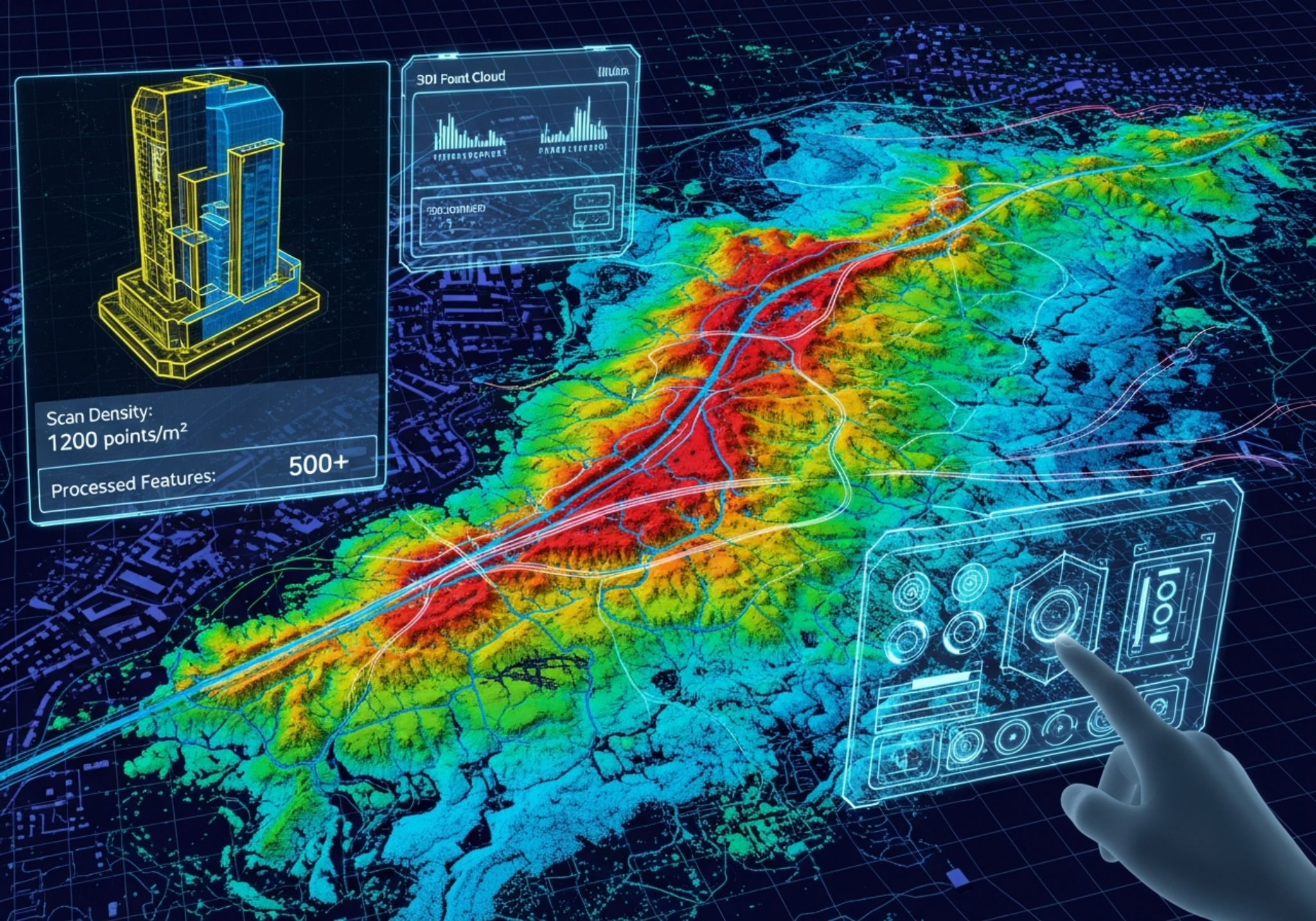
Elevation intelligence and terrain-focused engineering insights.
Visual terrain surfaces for planning and monitoring.

Structured delivery of precision mapping and utilities data.
Integrated drone, telecom, and digital city visualization.
Future-ready geospatial city visualization and data layers.
Elevation intelligence and terrain-focused engineering insights.